Ancient Antarctica Maps
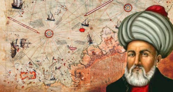
At first glance the map does truly appear clumsy and simply wrong; however, in actual fact, it is our modern understanding of the map that it wrong rather than much of the map itself. Some knowledge of ancient map making helps break the 'code' of the Piri Reis parchment. Nowadays map-making seems such a simple task given that we can take full aerial photographs of the planet from space. However, to the ancient cartographer, accurately reflecting a three dimensional globe of apparently unknown proportions onto a two-dimensional parchment was no easy matter. (Take a globe; flatten it out and the result shows continents miss-shaped and out of proportion.) The next difficulty facing the ancient map-maker was how to measure and construct a map. A modern map is constructed on a grid of lines of longitude and latitude, spaced at regular intervals on paper. Ancient maps, often referred to as 'portolan' maps (video, below - from 'port to port'), also have lines on them, however these lines appear to emanate from centres on the map, like spokes from a wheel. Each 'wheel' has either sixteen or thirty-two spokes flowing from it. The entire map would have been centred on some place, with concentric circles emanating out to provide as grid to be drawn upon.
The Piri Reis map is such a portolan map, and in order for its accuracy or not to be established, it needed to be converted into a modern map. This process, however, was further complicated by the fact that the map itself was a composite of may other maps, clumsily assembled into one. (Piri Reis noted that he had combined twenty maps into the world map, and there is no reason to believe that these individual twenty were themselves not composites of even earlier maps.) Mistakes such as showing the Amazon River twice or apparently failing to leave a gap at the tip of Southern America, thus leaving out a 900 mile section of coastline, are amongst many errors on the map. (This later error could be explained by the map of the Antarctica coastline being simply copied on too large a scale, leaving no room for Drake's Passage when the two maps were combined as one.) Piri Reis could, however, be forgiven. He had never visited Southern America and would therefore not have had any reason to believe there were errors in the parchment.
Once the necessary adjustments had been made, researchers claim the Piri Reis map is an accurate reflection of the coastline of Queen Maud Land in Antarctica before it was covered in ice. Apart from making these adjustments, there is other supporting evidence of this. Examination of the bottom area of the map appears to show islands off the coastline, and yet there are now no such islands. However, the drawing of these islands on the map actually support its authenticity.
The Seismic Survey of Antarctica, revealed a number of mountain ranges which, when the area was ice-free and sea levels were higher, would have appeared as islands off the coast matching those on the Piri Reis map. However, some researchers have been dismissive of this section of the map, stating that the coastline is probably from elsewhere, purely on the grounds that it cannot possibly be the Antarctic coastline before it was iced over. They propose that the coastline shown is actually part of South America. The argument is that if the land believed to be Antarctica was depicted vertically instead of horizontally it would bear a resemblance to the east coast of South America and could well restore some of the 'missing' 900 miles around Drake's Point. This would also account for the pictures of animals drawn on the map; they would not be in an ice-free Antarctica but in South America.
However Piri Reis, himself, answers critics who propose this argument, for he wrote on the map that night in the area shown is only "two hours long", highly indicative of Antarctic latitudes and hardly compatible with South American latitudes. (Those who refuse to accept that the map might show Antarctica in ice-free times forget that the Piri Reis map also shows Greenland to consist of three separate islands under the ice; a fact not known to modern man until the seismic data produced by Paul Emile Victor.) It appears that, somehow, sometime in our prehistory, someone unknown to us walked across the face of the planet, leaving behind intriguing clues to baffle later generations. But could man's history really be traced back to the time of the dinosaurs?
The riverbed at Paluxy appeared to have squared this circle with proof that man had indeed lived contemporaneously with these giants of the past. However up until the early 1980s the area had only been examined by those who wanted to believe in the mantracks and, as such, a more scientific approach was required to consider the claims made. Indeed up to 1982 mainstream scientists had largely ignored the situation, probably fanning the intrigue they had generated.
Then in 1982, then, a team of four scientists, Laurie Godfrey, Ron Hastings, John Cole and Steve Schafersman travelled to the riverbed to examine the prints for themselves. They called themselves the 'Raiders of the Lost Tracks' and in subsequent reports noted that, in their opinion, none of the tracks showed clear human features. Their work was brief, and in fairness not as thorough as could have been expected, however they were the first mainstream scientists to consider the issue. Claims and counter claims were made over subsequent years however the idea that the riverbed in Paluxy has man tracks side by side with dinosaur tracks now holds little credibility.